


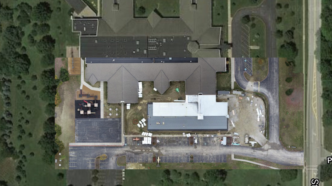
Mapping & 3D Imaging
Accurate aerial mapping of site conditions and new construction including creation of 3D models with elevation overlays.
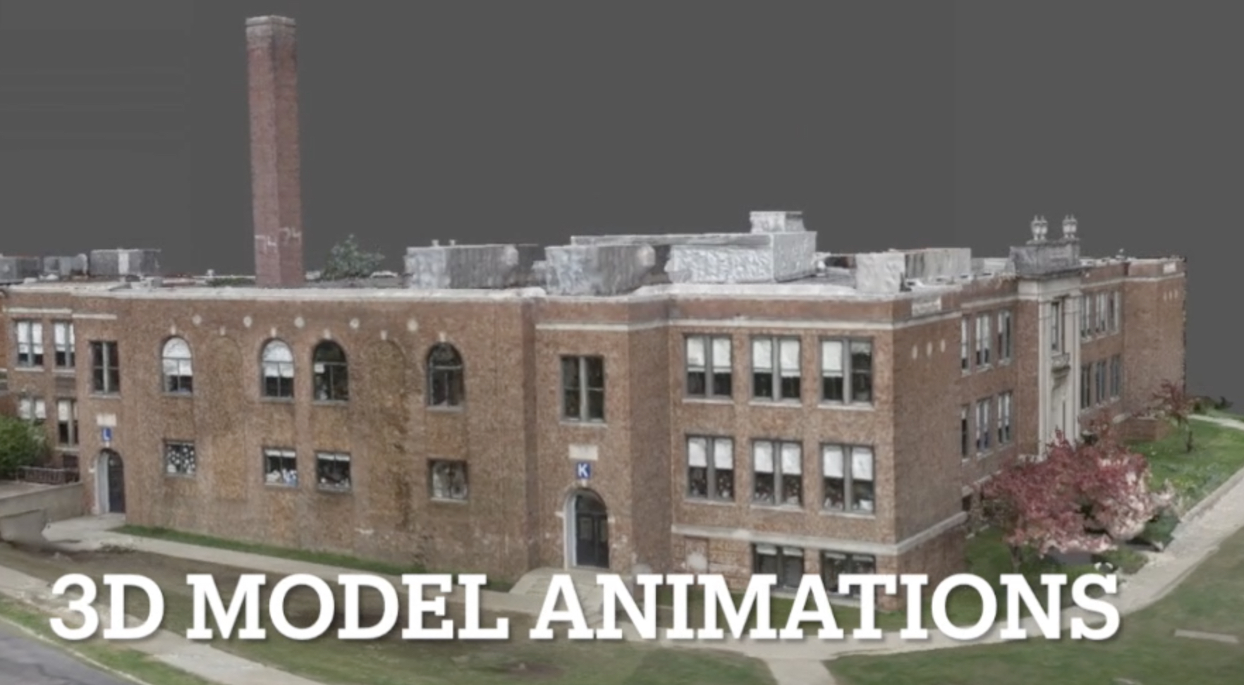
Virtual Fly-By
3D exterior models allow elimination of foliage and full animation.
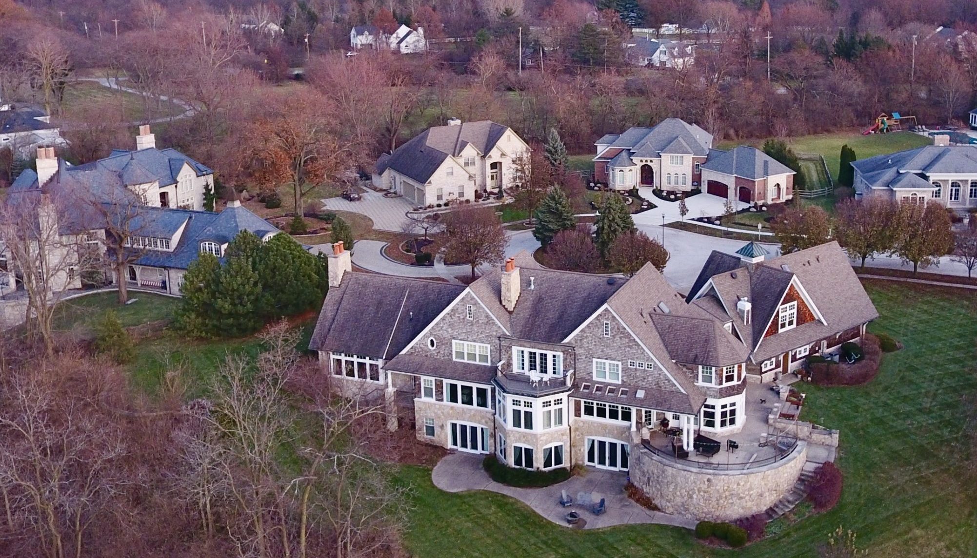
Real Estate
Commercial and Residential photography to showcase your building's or home's unique features.
Victor Aerial Services uses drone-derived data to create unique and interactive mechanisms for exploring, evaluating and documenting all types of real estate - from site plans to exterior/interior 3D modeling. We meld specialized flight techniques with advanced digital processing to produce novel and captivating deliverables.
![]()